Number Four Mountain may have an unimaginative name, but this is a fine hike in the Moosehead Lake region of Maine.
It’s a 3.3 mile out and back hike in which you’ll steadily climb 1,373 feet in elevation. The hike took me 1.5 hours to ascend to the summit and 1 hour to descend on the well marked trail through the woods.
Finding The Trail Head
The trail begins off the privately-owned but publicly accessible Meadow Brook Road.
From the blinking light in the center of Greenville travel north 13.1 miles on Lily Bay Road and turn right onto the Meadow Brook Road. At approximately 14.8 miles, turn left.
At approximately 17.2 miles bear left. The trail head is on the right approximately 500’-600’ ahead. A temporary parking area is another 500’-600’ ahead on the right, just past a small bridge over Lagoon Brook.
Finding the trail head to Number Four Mountain will be an adventure in itself on dirt roads deep in the Maine woods but now you have a nice hike to enjoy.
The Hike

You should find the trail to be well established and easy to follow through the woods.
I didn’t get lost once and that’s a big accomplishment for me.
After about 1 mile, the elevations steepens as you can see on the map.
You’ll be walking on a dirt path… No boulder scrambling on this hike. It’s a nice trail … just steep!
This is a heavily wooded area so you won’t have any view until you reach the 2890′ summit.
The view from the summit of Number Four Mountain is really nice, though it is partially obstructed by the tall trees around you.
You’ll see Lilly Bay and Moosehead Lake below you, as well as some of the neighboring Lilly Bay mountains.


I did this hike in 2017 when AMC was beginning construction on the trail continuation to Baker Mountain from the summit of Number Four Mountain.
I don’t know if that has been completed yet. Recent reviews on AllTrails don’t mention it, so I’m not sure what the status is, but I know that there’s a nice viewpoint with a bench just past the summit that I somehow missed.
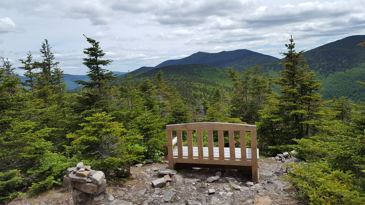
I found the above picture on Greg Westrich’s blog, author of the excellent book Hiking Maine. Ironically he did this hike on the same day as me, and he continued another 2.5 miles past the summit toward Baker Mountain until the trail ended.
Hopefully this trail continuation has been completed, or will soon, but at the very least I won’t miss that bench the next time I do this hike!
Moosehead Pinnacle Pursuit
The loop described here is one of six hikes that make up the Moosehead Pinnacle Pursuit challenge. The other five hikes, in order of difficulty from easiest to hardest (in my opinion), are Mount Kineo, Borestone Mountain, Big Moose Mountain, Eagle Rock, and Whitecap Mountain.